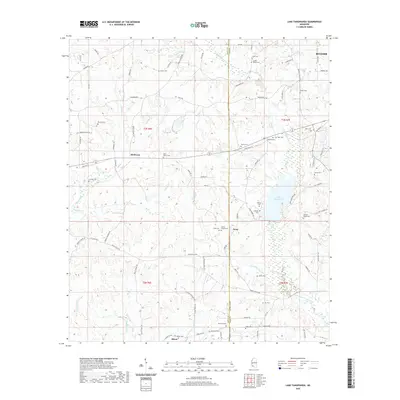
2020 Map of Lake Tangipahoa
USGS Topo · Published 2020About this map
The Tangipahoa River flows through this corner of Southwest Mississippi, where the boundary between Amite and Pike counties meets. The landscape is defined by the significant reservoir of Lake Tangipahoa, which serves as a central hub for the surrounding settlements of McElveen, Irene, and Mixon. Small family-named cemeteries are densely distributed across the hills and creek bottoms, including the Josiah Powell Cem and Harrell-Martin Cem, suggesting a long history of local kinship and land ownership.
Find a feature on this map
93 named features on this map. Tap any name to fly to it.
Don’t see what you’re looking for? This feature index may not catch every label — zoom into the map to look around manually.
Map Details
Editions of this 2020 Lake Tangipahoa Map
This is the sole edition of this map. No revisions or reprints were ever made.
Other maps of this area

1953 · Natchez
USGS Topo · 1:250,000

1956 · Natchez
USGS Topo · 1:250,000

1959 · Natchez
USGS Topo · 1:250,000

1972 · Smithdale
USGS Topo · 1:24,000
1972 · Osyka
USGS Topo · 1:24,000

1972 · Auburn
USGS Topo · 1:24,000

1972 · McComb South
USGS Topo · 1:24,000

1972 · Peoria
USGS Topo · 1:24,000

1972 · Lake Tangipahoa
USGS Topo · 1:24,000
1972 · McComb North
USGS Topo · 1:24,000