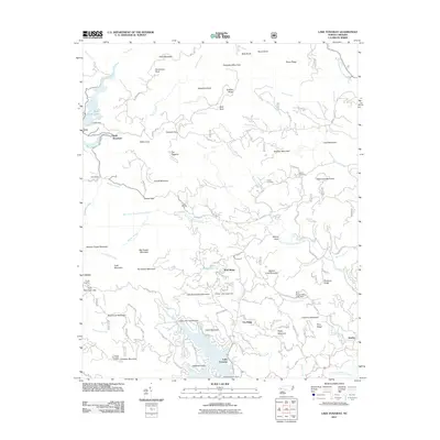
2011 Map of Lake Toxaway
USGS Topo · Published 2011About this map
Lake Toxaway and the surrounding high-elevation basins of the Blue Ridge define this portion of Transylvania County. The landscape is a complex of significant peaks like Toxaway Mountain and Panthertail Mountain, which overlook the headwaters of the Toxaway River and the West Fork French Broad River. Residential and recreational development is clustered around the lake's shoreline, marked by private drives such as W Shore Ln and N Club Dr, while the northern reaches remain dominated by ridges and gaps like Tanasee Gap and Owens Gap. The presence of Owens Cemetery and McCall Cemetery near Glassmine Mountain provides important focal points for genealogists researching family history in this corner of the state. Small settlements such as Quebec and Canaan anchor the outlying areas, connected by narrow mountain roads like Richland Creek Rd and Silverstein Rd.
Find a feature on this map
116 named features on this map. Tap any name to fly to it.
Don’t see what you’re looking for? This feature index may not catch every label — zoom into the map to look around manually.
Map Details
Editions of this 2011 Lake Toxaway Map
This is the sole edition of this map. No revisions or reprints were ever made.
Other maps of this area

1891 · Cowee
USGS Topo · 1:125,000

1897 · Cowee
USGS Topo · 1:125,000

1905 · Pisgah
USGS Topo · 1:125,000

1906 · Pisgah
USGS Topo · 1:125,000

1907 · Cowee
USGS Topo · 1:125,000

1935 · Eastatoe Gap
USGS Topo · 1:24,000

1935 · Sam Knob
USGS Topo · 1:24,000

1935 · Cashiers
USGS Topo · 1:24,000

1935 · Rosman
USGS Topo · 1:24,000

1935 · Tuckaseigee
USGS Topo · 1:24,000