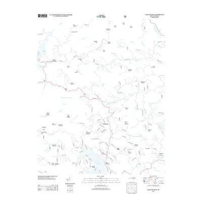
2013 Map of Lake Toxaway
USGS Topo · Published 2013About this map
Lake Toxaway and the surrounding high-elevation basins define this 2013 survey of the Blue Ridge terrain in Transylvania County. The map documents a landscape where residential developments like Wolf Ridge and Hogback Valley meet protected or primitive forest lands. Notable water features include the headwaters of the W Fork French Broad River and the Toxaway River, alongside the smaller T Fields Lake and Tanasee Creek Lake. Peaks like Toxaway Mountain, topped by the Toxaway Mountain Lookout, provide significant vertical relief against the valley floors. Local history and geography are preserved through labels for established communities such as Quebec and Canaan, as well as distinctive landmarks like Dismal Falls and the numerous named ridges and knobs that segment the drainage basins.
Find a feature on this map
142 named features on this map. Tap any name to fly to it.
Don’t see what you’re looking for? This feature index may not catch every label — zoom into the map to look around manually.
Map Details
Editions of this 2013 Lake Toxaway Map
This is the sole edition of this map. No revisions or reprints were ever made.
Other maps of this area

1891 · Cowee
USGS Topo · 1:125,000

1897 · Cowee
USGS Topo · 1:125,000

1905 · Pisgah
USGS Topo · 1:125,000

1906 · Pisgah
USGS Topo · 1:125,000

1907 · Cowee
USGS Topo · 1:125,000

1935 · Eastatoe Gap
USGS Topo · 1:24,000

1935 · Sam Knob
USGS Topo · 1:24,000

1935 · Cashiers
USGS Topo · 1:24,000

1935 · Rosman
USGS Topo · 1:24,000

1935 · Tuckaseigee
USGS Topo · 1:24,000