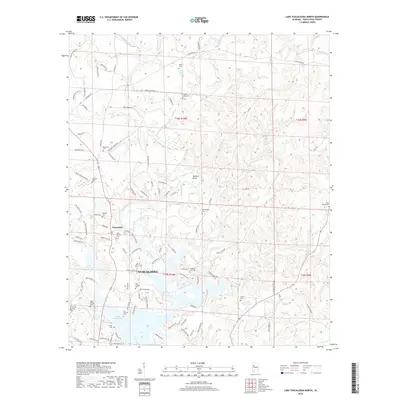
2018 Map of Lake Tuscaloosa North
USGS Topo · Published 2018About this map
Lake Tuscaloosa dominates the southern landscape of this northern Alabama terrain, where the North River feeds into the reservoir. The topography is defined by narrow ridges and winding creek valleys such as Cripple Cr and Turkey Cr, which dictated the early placement of family farms and communities. The map highlights numerous small burial grounds and springs, such as Widow Jones Spring and the Old Prewitte Cem, providing a dense network of landmarks for genealogists.
Find a feature on this map
107 named features on this map. Tap any name to fly to it.
Don’t see what you’re looking for? This feature index may not catch every label — zoom into the map to look around manually.
Map Details
Editions of this 2018 Lake Tuscaloosa North Map
This is the sole edition of this map. No revisions or reprints were ever made.
Other maps of this area

1893 · Jasper
USGS Topo · 1:125,000

1899 · Brookwood
USGS Topo · 1:125,000

1926 · Samantha
USGS Topo · 1:48,000

1928 · Samantha
USGS Topo · 1:62,500

1929 · Searles
USGS Topo · 1:48,000

1934 · Searles
USGS Topo · 1:62,500

1949 · Wiley
USGS Topo · 1:24,000

1951 · Wiley
USGS Topo · 1:24,000

1953 · Birmingham
USGS Topo · 1:250,000

1956 · Birmingham
USGS Topo · 1:250,000