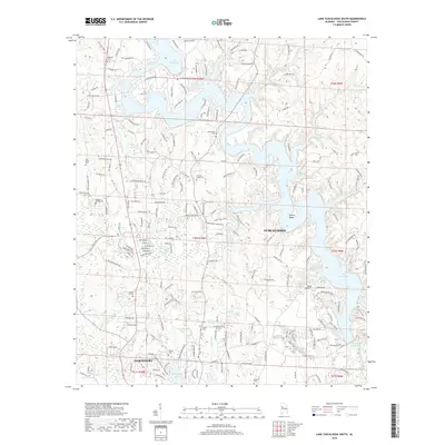
2018 Map of Lake Tuscaloosa South
USGS Topo · Published 2018About this map
Lake Tuscaloosa dominates this part of West Alabama, its dendritic shoreline reaching into the hills north of the Black Warrior River. The map documents the residential expansion of Northport and Tuscaloosa as they grow toward the reservoir's edge. This modern landscape is layered over a foundation of older family and community markers, such as Carrolls Creek Cem, Taylor Cem, and the Macedonia Ch. While newer developments like Northwood Lake and Carolwood Lake appear in the southern sections, the northern reaches maintain a more rural character defined by timbered ridges and deep inlets like Sexton Bend. Small private lakes such as Watts Lake and Swanson Lake dot the terrain, while the massive William Bacon Oliver Lake anchors the southern boundary near the river's main channel. The topography here is intricate, with Stephens Mountain rising above the valleys of Carroll Cr and Twomile Cr.
Find a feature on this map
213 named features on this map. Tap any name to fly to it.
Don’t see what you’re looking for? This feature index may not catch every label — zoom into the map to look around manually.
Map Details
Editions of this 2018 Lake Tuscaloosa South Map
This is the sole edition of this map. No revisions or reprints were ever made.
Other maps of this area

1899 · Brookwood
USGS Topo · 1:125,000

1924 · Tuscaloosa
USGS Topo · 1:62,500

1926 · Samantha
USGS Topo · 1:48,000

1926 · Tuscaloosa
USGS Topo · 1:62,500

1928 · Samantha
USGS Topo · 1:62,500

1929 · Searles
USGS Topo · 1:48,000

1931 · Cottondale
USGS Topo · 1:48,000

1934 · Searles
USGS Topo · 1:62,500

1934 · Cottondale
USGS Topo · 1:62,500

1953 · Birmingham
USGS Topo · 1:250,000