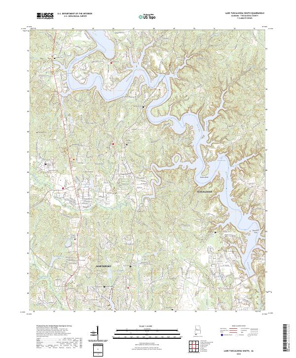
2024 Map of Lake Tuscaloosa South
USGS Topo · Published 2024About this map
Lake Tuscaloosa and its winding northern fingers dominate this modern landscape where the North River and its tributaries define the local geography. The map detail reflects a transition from suburban residential developments near Northport and Tuscaloosa to the more wooded, dissected terrain around Stephens Mountain. Local history and genealogy are well-represented by a high density of rural cemeteries, including Carrolls Creek Cem, Bethel Cem, and Macedonia Cem, which remain as markers of the area's older social fabric amidst 21st-century growth. Water remains the primary feature, with numerous named catchments such as Carolwood Lake, Houses Lake, and Swanson Lake scattered throughout the valleys of Carroll Creek and Twomile Creek. Significant bends in the river system, notably Sexton Bend, illustrate the complex hydrology that continues to shape land use in this part of Alabama.
Find a feature on this map
235 named features on this map. Tap any name to fly to it.
Don’t see what you’re looking for? This feature index may not catch every label — zoom into the map to look around manually.
Map Details
Editions of this 2024 Lake Tuscaloosa South Map
This is the sole edition of this map. No revisions or reprints were ever made.
Other maps of this area

1899 · Brookwood
USGS Topo · 1:125,000

1924 · Tuscaloosa
USGS Topo · 1:62,500

1926 · Samantha
USGS Topo · 1:48,000

1926 · Tuscaloosa
USGS Topo · 1:62,500

1928 · Samantha
USGS Topo · 1:62,500

1929 · Searles
USGS Topo · 1:48,000

1931 · Cottondale
USGS Topo · 1:48,000

1934 · Searles
USGS Topo · 1:62,500

1934 · Cottondale
USGS Topo · 1:62,500

1953 · Birmingham
USGS Topo · 1:250,000