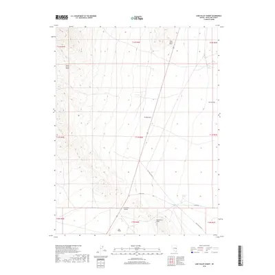
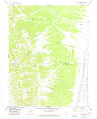
2018 Map of Lake Valley Summit
USGS Topo · Published 2018About this map
Lake Valley Summit serves as the topographic anchor for this section of eastern Nevada, where the high desert floor meets the rising peaks of two distinct mountain chains. The map documents the western edge of Spring Valley and the vast Lake Valley floor, which are separated by prominent rises like Kirkeby Knoll and South Spring Point. This area is defined by its seasonal and perennial water sources, including South Spring and South Fox Spring, which provide critical points of interest for those tracking historical land use and travel routes through the Great Basin. Transportation through this remote terrain is mapped along modern corridors like White Pine Co Road 47 and S Highline Rd. The geography here transitions from the eastern slopes of the Schell Creek Range to the northern reaches of the Fortification Range, offering a clear view of the basin-and-range structures that shaped regional exploration and ranching.
Find a feature on this map
20 named features on this map. Tap any name to fly to it.
Don’t see what you’re looking for? This feature index may not catch every label — zoom into the map to look around manually.
Map Details
Editions of this 2018 Lake Valley Summit Map
This is the sole edition of this map. No revisions or reprints were ever made.
Other maps of this area

1948 · Wheeler Peak
USGS Topo · 1:62,500

1950 · Wheeler Peak
USGS Topo · 1:62,500

1956 · Lund
USGS Topo · 1:250,000

1960 · Lund
USGS Topo · 1:250,000

1973 · Indian Springs Knolls
USGS Topo · 1:24,000

1973 · Cattle Camp Spring
USGS Topo · 1:24,000
1973 · North Spring Point
USGS Topo · 1:24,000
1973 · Mount Grafton NE
USGS Topo · 1:24,000
1973 · Horse Camp Springs
USGS Topo · 1:24,000
1978 · Mt. Grafton
USGS Topo · 1:24,000