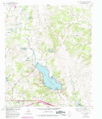
1959 Map of Lake Weatherford
USGS Topo · Published 1992About this map
Lake Weatherford serves as the focal point of this Parker County landscape, where the Clear Fork Trinity River is harnessed by an extensive system of water management infrastructure. Numerous reservoirs, such as Reservoir No 16 and Reservoir No 21, dot the surrounding hills, feeding into branches like Patton Branch and Silver Creek. This hydraulic network supports small rural clusters and ranching outposts, including Dicey and the Shangri-La Ranch.
Find a feature on this map
50 named features on this map. Tap any name to fly to it.
Don’t see what you’re looking for? This feature index may not catch every label — zoom into the map to look around manually.
Map Details
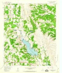
Editions of this 1959 Lake Weatherford Map
2 editions found
Other maps of this area

1891 · Weatherford
USGS Topo · 1:125,000

1893 · Weatherford
USGS Topo · 1:125,000

1931 · Dennis
USGS Topo · 1:62,500

1932 · Springtown
USGS Topo · 1:62,500

1954 · Dallas
USGS Topo · 1:250,000

1955 · Aledo
USGS Topo · 1:24,000

1955 · Azle
USGS Topo · 1:24,000
1955 · Springtown SE
USGS Topo · 1:24,000

1958 · Dallas
USGS Topo · 1:250,000

1958 · Springtown
USGS Topo · 1:24,000