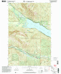
2004 Map of Lake Wenatchee
USGS Topo · Published 2008About this map
Lake Wenatchee sits at the heart of this North Cascades landscape, serving as the terminal point for the White River and Little Wenatchee River. The topography is dominated by the massive presence of Dirtyface Mountain and Nason Ridge, which define the drainage basins for numerous mountain streams like Roaring Creek and Butcher Creek. In the southern portion of the quadrangle, the small settlement of Merritt provides a focal point for researchers of regional transport history, situated along the corridor that includes the Stevens Pass Greenway and Nason Creek. High-altitude landmarks such as Alpine Lookout and Round Mountain underscore the prominence of the Wenatchee National Forest management in this era. For recreation history, the inclusion of Camp Zanika Lache and the Glacier View area offers specific data on shoreline development and forest access in the early 2000s.
Find a feature on this map
34 named features on this map. Tap any name to fly to it.
Don’t see what you’re looking for? This feature index may not catch every label — zoom into the map to look around manually.
Map Details
Editions of this 2004 Lake Wenatchee Map
This is the sole edition of this map. No revisions or reprints were ever made.
Other maps of this area

1901 · Chiwaukum
USGS Topo · 1:125,000

1904 · Chiwaukum
USGS Topo · 1:125,000

1957 · Wenatchee
USGS Topo · 1:250,000

1964 · Leavenworth
USGS Topo · 1:62,500

1965 · Chiwaukum Mts
USGS Topo · 1:62,500

1965 · Wenatchee Lake
USGS Topo · 1:62,500
1968 · Plain
USGS Topo · 1:24,000
1968 · Chikamin Creek
USGS Topo · 1:24,000
1975 · Chelan
USGS Topo · 1:100,000
1989 · Big Jim Mountain
USGS Topo · 1:24,000