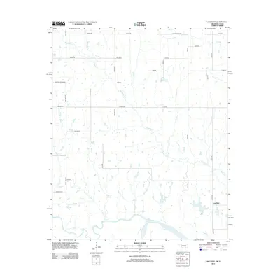
2013 Map of Lake West
USGS Topo · Published 2013About this map
The Blue River and Red River converge at the southern edge of this Oklahoma-Texas borderlands landscape, defining a region where water and history intersect. In the 2010s, the rural community of Lake West serves as the primary focal point, surrounded by a dense network of sectional roads and natural springs. Smaller waterways like Whitegrass Cr and Frazier Cr carve through the terrain, while landmarks such as Patsy Spring and Sibly Spring indicate the long-standing importance of reliable water sources in this agricultural environment. The road names themselves, such as Post Oak Crossing Rd and Wilson School Rd, hint at the locations of former community centers and historic landmarks that once anchored the local population. This survey illustrates the persistent rural character of the border region, showcasing the relationship between the shifting riverbanks and the grid of established homesteads.
Find a feature on this map
40 named features on this map. Tap any name to fly to it.
Don’t see what you’re looking for? This feature index may not catch every label — zoom into the map to look around manually.
Map Details
Editions of this 2013 Lake West Map
This is the sole edition of this map. No revisions or reprints were ever made.
Other maps of this area

1899 · Atoka
USGS Topo · 1:125,000

1900 · Atoka
USGS Topo · 1:125,000

1901 · Antlers
USGS Topo · 1:125,000

1903 · Paris
USGS Topo · 1:125,000

1912 · Antlers
USGS Topo · 1:125,000

1925 · Antlers
USGS Topo · 1:125,000

1948 · Direct
USGS Topo · 1:62,500

1949 · Direct
USGS Topo · 1:62,500

1950 · Mcalester
USGS Topo · 1:250,000

1953 · Texarkana
USGS Topo · 1:250,000