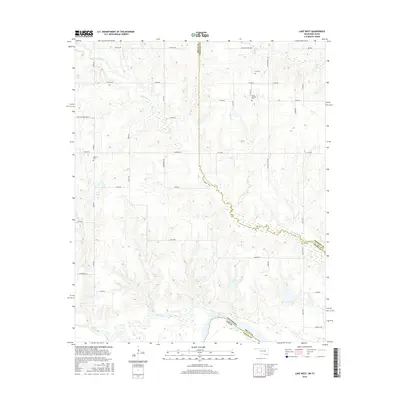
2016 Map of Lake West
USGS Topo · Published 2016About this map
The Red River forms the winding southern boundary of this Oklahoma-Texas borderland, where the winding Blue River also converges near the state line. The landscape is defined by a complex network of waterways including Whitegrass Cr, Slough Cr, and Frazier Cr. Local heritage is anchored by rural landmarks such as Dill Cem, Good Springs Cem, and Jackson Cem, which reflect the community's ancestral roots in Bryan and Choctaw Counties. Smaller water features like Page Lake, Teal Lake, and the named Sibly Spring and Patsy Spring suggest a territory shaped by its hydrology. The road network, including the specifically named Wilson School Rd, Post Oak Crossing RD, and Oberlin RD, provides a window into the rural settlement patterns and local infrastructure of the early 21st century.
Find a feature on this map
49 named features on this map. Tap any name to fly to it.
Don’t see what you’re looking for? This feature index may not catch every label — zoom into the map to look around manually.
Map Details
Editions of this 2016 Lake West Map
This is the sole edition of this map. No revisions or reprints were ever made.
Other maps of this area

1899 · Atoka
USGS Topo · 1:125,000

1900 · Atoka
USGS Topo · 1:125,000

1901 · Antlers
USGS Topo · 1:125,000

1903 · Paris
USGS Topo · 1:125,000

1912 · Antlers
USGS Topo · 1:125,000

1925 · Antlers
USGS Topo · 1:125,000

1948 · Direct
USGS Topo · 1:62,500

1949 · Direct
USGS Topo · 1:62,500

1950 · Mcalester
USGS Topo · 1:250,000

1953 · Texarkana
USGS Topo · 1:250,000