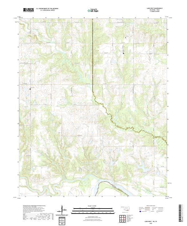
2022 Map of Lake West
USGS Topo · Published 2022About this map
The Red River defines the southern boundary of this territory, where the state line meets the Bryan and Fannin County line. This landscape is shaped by the winding courses of Whitegrass Creek and Whitesand Creek, which flow through a network of rural roads such as Post Oak Crossing Road and Chishoktak Road. Local history is preserved in small family and community burial grounds, including Good Springs Cemetery and Dill Cemetery in the northern sections, and Jackson Cemetery to the west. Evidence of the area's natural hydrology is seen in named features like Siby Spring and Patsy Spring, which feed the local drainages north of the river. The southern edge follows the meandering border with Texas, while the internal divisions reflect the boundaries of the Choctaw and Bryan County line.
Find a feature on this map
37 named features on this map. Tap any name to fly to it.
Don’t see what you’re looking for? This feature index may not catch every label — zoom into the map to look around manually.
Map Details
Editions of this 2022 Lake West Map
This is the sole edition of this map. No revisions or reprints were ever made.
Other maps of this area

1899 · Atoka
USGS Topo · 1:125,000

1900 · Atoka
USGS Topo · 1:125,000

1901 · Antlers
USGS Topo · 1:125,000

1903 · Paris
USGS Topo · 1:125,000

1912 · Antlers
USGS Topo · 1:125,000

1925 · Antlers
USGS Topo · 1:125,000

1948 · Direct
USGS Topo · 1:62,500

1949 · Direct
USGS Topo · 1:62,500

1950 · Mcalester
USGS Topo · 1:250,000

1953 · Texarkana
USGS Topo · 1:250,000