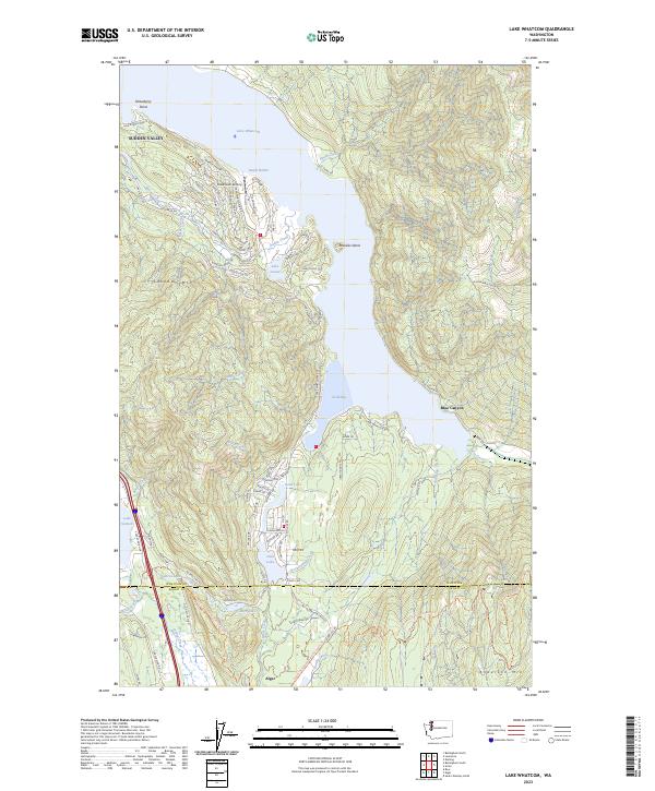
2023 Map of Lake Whatcom
USGS Topo · Published 2023About this map
Lake Whatcom dominates this landscape, extending from Dutch Harbor and Strawberry Point southward toward South Bay. The residential development of Sudden Valley lines the western shore, showcasing a dense network of suburban streets like Sudden Valley Dr and Lake Whatcom Blvd that contrast with the steep, wooded slopes of Lookout Mtn. To the south, the terrain becomes more industrial and rural, marked by the tracks of the BNSF Railway following the edge of Lake Samish and the Whatcom Co and Skagit Co line.
Find a feature on this map
92 named features on this map. Tap any name to fly to it.
Don’t see what you’re looking for? This feature index may not catch every label — zoom into the map to look around manually.
Map Details
Editions of this 2023 Lake Whatcom Map
This is the sole edition of this map. No revisions or reprints were ever made.
Other maps of this area

1906 · Sumas
USGS Topo · 1:62,500

1908 · Sumas
USGS Topo · 1:62,500

1918 · Samish Lake
USGS Topo · 1:62,500

1919 · Van Zandt
USGS Topo · 1:62,500

1921 · Wickersham
USGS Topo · 1:62,500

1951 · Wickersham
USGS Topo · 1:62,500

1951 · Van Zandt
USGS Topo · 1:62,500

1952 · Lake Whatcom
USGS Topo · 1:24,000

1952 · Lawrence
USGS Topo · 1:24,000

1952 · Alger
USGS Topo · 1:24,000