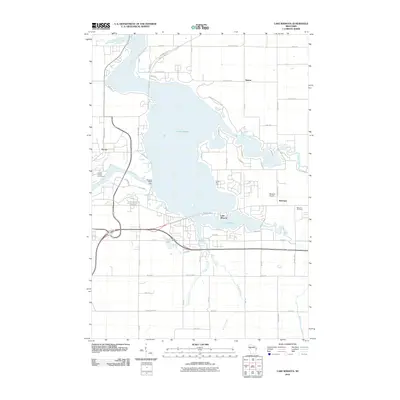
2010 Map of Lake Wissota
USGS Topo · Published 2010About this map
Lake Wissota dominates the center of this landscape, formed by the Wissota-WP37 Dam which harnesses the Chippewa River. The shoreline is heavily developed with recreational and residential features, including the expansive Lake Wissota State Park on the northeastern banks and the private Camp Sko-Lo-A to the south. Small outlying communities like Norma and Anson are mapped alongside the agricultural settlement of Bateman, where the Bateman Cemetery serves as a local genealogical landmark.
Find a feature on this map
42 named features on this map. Tap any name to fly to it.
Don’t see what you’re looking for? This feature index may not catch every label — zoom into the map to look around manually.
Map Details
Editions of this 2010 Lake Wissota Map
This is the sole edition of this map. No revisions or reprints were ever made.
Other maps of this area

1934 · Chippewa Falls
USGS Topo · 1:62,500

1936 · Chippewa Falls
USGS Topo · 1:62,500

1949 · Bloomer
USGS Topo · 1:62,500

1951 · Bloomer
USGS Topo · 1:62,500

1951 · Cornell
USGS Topo · 1:62,500

1952 · Cadott
USGS Topo · 1:62,500

1953 · Eau Claire
USGS Topo · 1:250,000

1953 · Rice Lake
USGS Topo · 1:250,000

1958 · Eau Claire
USGS Topo · 1:250,000

1959 · Rice Lake
USGS Topo · 1:250,000