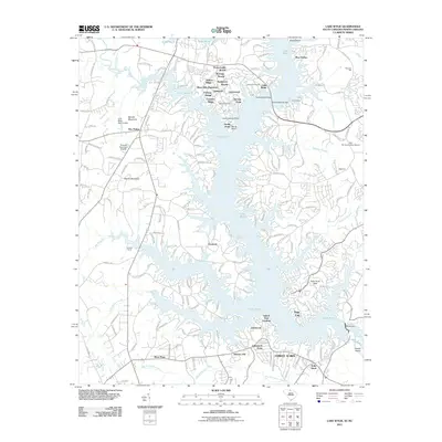
2011 Map of Lake Wylie
USGS Topo · Published 2011About this map
Lake Wylie serves as the focal point of this 2011 survey, showing the intricate shoreline and residential development along the South Carolina and North Carolina border. The landscape is characterized by numerous peninsulas and planned communities such as River Hills Plantation, Tega Cay, and Forest Acres. Transportation across the water is anchored by the Buster Boyd Bridge, connecting the many fingers of land that reach into the lake.
Find a feature on this map
45 named features on this map. Tap any name to fly to it.
Don’t see what you’re looking for? This feature index may not catch every label — zoom into the map to look around manually.
Map Details
Editions of this 2011 Lake Wylie Map
This is the sole edition of this map. No revisions or reprints were ever made.
Other maps of this area

1905 · Charlotte
USGS Topo · 1:48,000

1907 · Charlotte
USGS Topo · 1:62,500

1941 · Charlotte
USGS Topo · 1:125,000

1941 · Spartanburg
USGS Topo · 1:250,000

1942 · Charlotte
USGS Topo · 1:125,000

1947 · Clover
USGS Topo · 1:62,500

1948 · Charlotte West
USGS Topo · 1:24,000

1949 · Clover
USGS Topo · 1:62,500

1949 · Charlotte West
USGS Topo · 1:24,000

1949 · Rock Hill
USGS Topo · 1:62,500