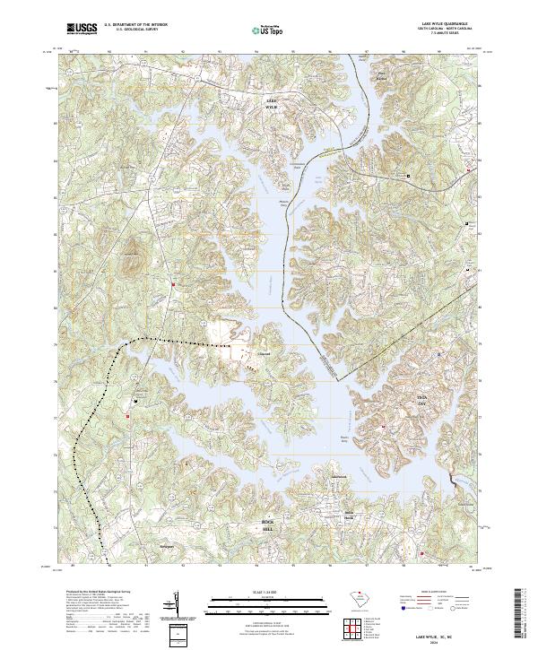
2024 Map of Lake Wylie
USGS Topo · Published 2024About this map
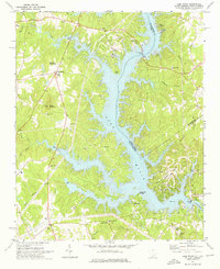
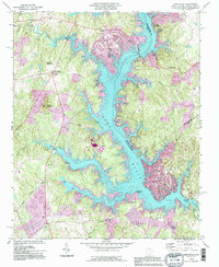
Lake Wylie serves as the dominant geographical feature of this borderland, where the Catawba River winds across the state line between South Carolina and North Carolina. The intricate shoreline is defined by numerous inlets and points such as Commodore Point and South Point, reflecting the modern development of lakeside communities like Tega Cay and Pine Harbor. This landscape is marked by the persistence of historical landmarks, including old river crossings at Masons Ferry and Thorns Ferry, which suggest the older transport routes used before the river was dammed.
Find a feature on this map
64 named features on this map. Tap any name to fly to it.
Don’t see what you’re looking for? This feature index may not catch every label — zoom into the map to look around manually.
Map Details
Editions of this 2024 Lake Wylie Map
This is the sole edition of this map. No revisions or reprints were ever made.
Historical Maps of India Hook Through Time
4 maps found