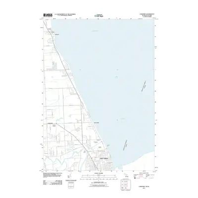
2011 Map of Lakeport
USGS Topo · Published 2011About this map
Lake Huron defines the eastern boundary of this coastal region, where the international border with Canada runs through the open water. The shoreline is punctuated by the historic Fort Gratiot Light, marking the entrance to the St. Clair River system near the northern reaches of Port Huron. Inland, the landscape transitions from the residential clusters of Keewahdin and Gardendale to the more rural character surrounding Lakeport. A significant concentration of burial grounds, including Mount Hope Cemetery, Lakeside Cemetery, and Veterans Cemetery, provides a dense record of local genealogy. The winding course of the Black River meets the lakefront near the River Tower Marina, illustrating the maritime and residential interface of the area during the early 21st century.
Find a feature on this map
35 named features on this map. Tap any name to fly to it.
Don’t see what you’re looking for? This feature index may not catch every label — zoom into the map to look around manually.
Map Details
Editions of this 2011 Lakeport Map
This is the sole edition of this map. No revisions or reprints were ever made.
Other maps of this area

1912 · Port Huron
USGS Topo · 1:62,500

1928 · Hicky
USGS Topo · 1:62,500

1929 · Port Huron
USGS Topo · 1:62,500

1939 · Port Huron
USGS Topo · 1:24,000

1939 · Smiths Creek
USGS Topo · 1:24,000
1949 · Port Huron
USGS Topo · 1:24,000
1952 · Smiths Creek
USGS Topo · 1:24,000
1952 · Port Huron
USGS Topo · 1:24,000

1954 · Detroit
USGS Topo · 1:250,000

1954 · Flint
USGS Topo · 1:250,000