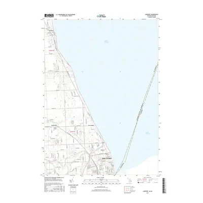
2017 Map of Lakeport
USGS Topo · Published 2017About this map
Port Huron and its northern lakefront suburbs define this coastal landscape along the southwestern shore of Lake Huron. The map documents a transition from the urban density of the city’s northern edge to the residential and seasonal settlements of Keewahdin, Gardendale, and Lakeport. A significant portion of the inland geography is shaped by the Black River and the engineered Black River Canal, which cuts toward the lake. Genealogists and local historians will find an exceptional concentration of burial sites concentrated near the city limits, including Mt Hope Catholic Cem, the Lakeside Cem Soldiers Lot, and Mount Sinai Cem. These sites, along with the Veterans Cem, reflect the community's established history and its role as a regional center near the international boundary with Canada.
Find a feature on this map
106 named features on this map. Tap any name to fly to it.
Don’t see what you’re looking for? This feature index may not catch every label — zoom into the map to look around manually.
Map Details
Editions of this 2017 Lakeport Map
This is the sole edition of this map. No revisions or reprints were ever made.
Other maps of this area

1912 · Port Huron
USGS Topo · 1:62,500

1928 · Hicky
USGS Topo · 1:62,500

1929 · Port Huron
USGS Topo · 1:62,500

1939 · Port Huron
USGS Topo · 1:24,000

1939 · Smiths Creek
USGS Topo · 1:24,000
1949 · Port Huron
USGS Topo · 1:24,000
1952 · Smiths Creek
USGS Topo · 1:24,000
1952 · Port Huron
USGS Topo · 1:24,000

1954 · Detroit
USGS Topo · 1:250,000

1954 · Flint
USGS Topo · 1:250,000