2023 Map of Lakeport
USGS Topo · Published 2023About this map
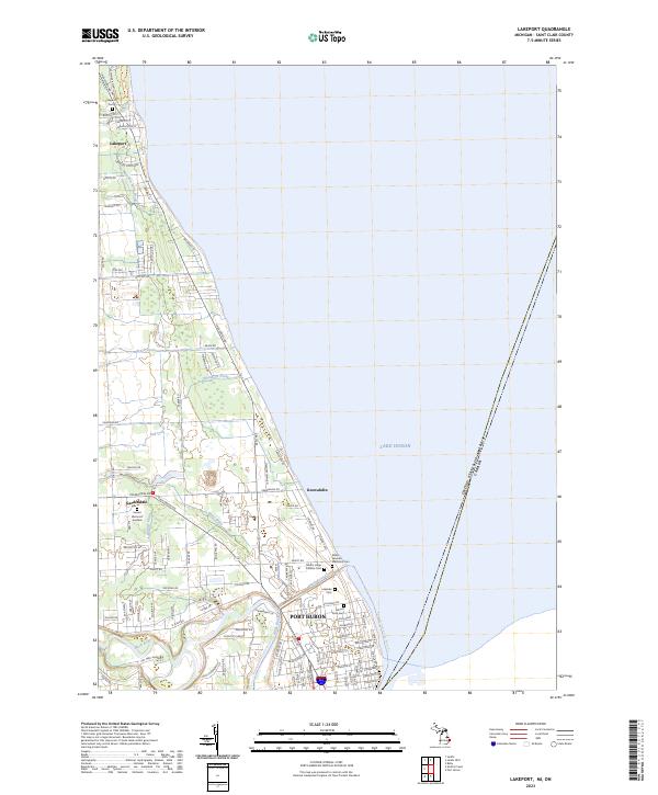
The coastline of Lake Huron defines the landscape of this St. Clair County survey, where residential developments like Keewahdin and Gardendale sit just north of Port Huron. The interface between land and water is managed by an intricate system of channels including the Black River-Canal, Meadow Lawn Drain, and Thompson Drain, reflecting the suburban drainage patterns of the modern era. Much of the northern shoreline is preserved within Lakeport State Park, providing a distinct break from the residential grids found further south near Keewahdin Rd.
Find a feature on this map
128 named features on this map. Tap any name to fly to it.
Don’t see what you’re looking for? This feature index may not catch every label — zoom into the map to look around manually.
Map Details
Editions of this 2023 Lakeport Map
This is the sole edition of this map. No revisions or reprints were ever made.