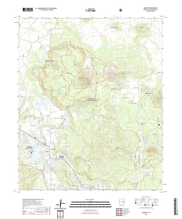
2021 Map of Lakeside
USGS Topo · Published 2021About this map
Pinetop-Lakeside and the surrounding high country are defined by a complex network of recreational and motorized trails within the Sitgreaves National Forest. The landscape features a mix of volcanic landmarks like Porter Mtn and Blue Ridge Mtn interspersed with significant water resources such as Rainbow Lake, Show Low Lake, and Scotts Reservoir. The settlement pattern reflects the area's growth from early ranching and rail origins, evidenced by Sponseller Siding, into a modern residential and resort hub.
Find a feature on this map
110 named features on this map. Tap any name to fly to it.
Don’t see what you’re looking for? This feature index may not catch every label — zoom into the map to look around manually.
Map Details
Editions of this 2021 Lakeside Map
This is the sole edition of this map. No revisions or reprints were ever made.
Other maps of this area

1886 · St Johns
USGS Topo · 1:250,000

1886 · Holbrook
USGS Topo · 1:250,000

1892 · St Johns
USGS Topo · 1:250,000

1893 · Holbrook
USGS Topo · 1:250,000

1954 · Holbrook
USGS Topo · 1:250,000

1954 · Saint Johns
USGS Topo · 1:250,000

1957 · Holbrook
USGS Topo · 1:250,000

1957 · Saint Johns
USGS Topo · 1:250,000

1958 · Saint Johns
USGS Topo · 1:250,000

1958 · Holbrook
USGS Topo · 1:250,000