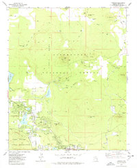
1977 Map of Lakeside
USGS Topo · Published 1978About this map
The Mogollon Rim forms a dramatic southern boundary in this late 1970s landscape, where high-country settlements like Lakeside and Pinetop are defined by their proximity to water and timber. The map illustrates a developed recreational and residential infrastructure centered on Rainbow Lake and Lake of the Woods, featuring several campgrounds and a Trailer Park. This era of growth is further evidenced by the Blue Ridge HS and local landmarks like the Springer Mtn Lookout.
Find a feature on this map
58 named features on this map. Tap any name to fly to it.
Don’t see what you’re looking for? This feature index may not catch every label — zoom into the map to look around manually.
Map Details
Editions of this 1977 Lakeside Map
This is the sole edition of this map. No revisions or reprints were ever made.
Other maps of this area

1886 · St Johns
USGS Topo · 1:250,000

1886 · Holbrook
USGS Topo · 1:250,000

1892 · St Johns
USGS Topo · 1:250,000

1893 · Holbrook
USGS Topo · 1:250,000

1954 · Holbrook
USGS Topo · 1:250,000

1954 · Saint Johns
USGS Topo · 1:250,000

1957 · Holbrook
USGS Topo · 1:250,000

1957 · Saint Johns
USGS Topo · 1:250,000

1958 · Saint Johns
USGS Topo · 1:250,000

1958 · Holbrook
USGS Topo · 1:250,000