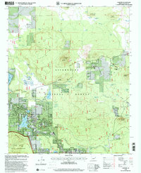
1998 Map of Lakeside
USGS Topo · Published 2001About this map
The town of Lakeside and the adjacent community of Pinetop serve as the focal points for this 1990s-era survey of the high country above the Mogollon Rim. This landscape is defined by its transition from the dense Timber of the Sitgreaves National Forest to the open flats and volcanic features that dot the region. Numerous springs and reservoirs like Rainbow Lake and Scott Reservoir illustrate the critical water management of the area, while the presence of the Porter Spring Rearing Ponds highlights the importance of local wildlife resources.
Find a feature on this map
78 named features on this map. Tap any name to fly to it.
Don’t see what you’re looking for? This feature index may not catch every label — zoom into the map to look around manually.
Map Details
Editions of this 1998 Lakeside Map
This is the sole edition of this map. No revisions or reprints were ever made.
Other maps of this area

1886 · St Johns
USGS Topo · 1:250,000

1886 · Holbrook
USGS Topo · 1:250,000

1892 · St Johns
USGS Topo · 1:250,000

1893 · Holbrook
USGS Topo · 1:250,000

1954 · Holbrook
USGS Topo · 1:250,000

1954 · Saint Johns
USGS Topo · 1:250,000

1957 · Holbrook
USGS Topo · 1:250,000

1957 · Saint Johns
USGS Topo · 1:250,000

1958 · Saint Johns
USGS Topo · 1:250,000

1958 · Holbrook
USGS Topo · 1:250,000