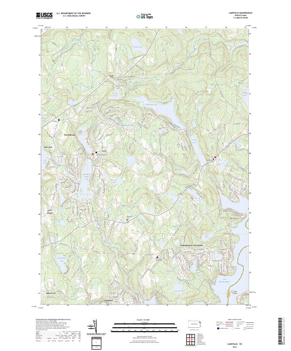
2023 Map of Lakeville
USGS Topo · Published 2023About this map
Lake Wallenpaupack anchors the southeastern corner of this region in Wayne County, where the landscape is defined by a dense network of water bodies and residential lake communities. The map highlights the transition from traditional settlements like Avoy and Lake Ariel to modern planned developments such as The Hideout and Wallenpaupack Lake Estates. These areas are characterized by a labyrinth of local roads like Sunrise TRL and Robin LN, indicating a high-density vacation and residential geography. Local history is preserved in small landmarks, including the Avoy Christian Church and several community burial grounds such as Tisdale Cem and Arlington Cem. Moving toward Ledgedale, the terrain remains concentrated with private lakes including Waynewood Lake and Lake Lacawac, illustrating the extensive water-based development that has shaped this portion of the Poconos.
Find a feature on this map
174 named features on this map. Tap any name to fly to it.
Don’t see what you’re looking for? This feature index may not catch every label — zoom into the map to look around manually.
Map Details
Editions of this 2023 Lakeville Map
This is the sole edition of this map. No revisions or reprints were ever made.
Other maps of this area

1892 · Honesdale
USGS Topo · 1:62,500

1920 · Damascus
USGS Topo · 1:62,500

1923 · Damascus
USGS Topo · 1:62,500

1928 · Ariel
USGS Topo · 1:62,500

1932 · Ariel
USGS Topo · 1:62,500

1935 · Hawley
USGS Topo · 1:62,500

1938 · Hawley
USGS Topo · 1:62,500

1943 · Honesdale
USGS Topo · 1:125,000

1944 · Damascus
USGS Topo · 1:62,500

1946 · Honesdale
USGS Topo · 1:24,000
Featured Places
- Cherry Ridge Township, PA
- South Canaan Township, PA
- Greene Township, PA
- Paupack Township, PA
- Palmyra Township, PA