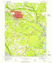
1954 Map of Lakewood
USGS Topo · Published 1956About this map
Lakewood serves as the primary urban hub on this mid-century survey, surrounded by a landscape of scattered settlements and burgeoning infrastructure in Ocean County. The campus of Georgian Court College and the surrounding street grid near Lake Carasaljo contrast with the agricultural character of the outlying areas. To the south and east, numerous smaller communities like Seven Stars, Lanes Mills, and Silverton are connected by a growing network of state highways and the Central Railroad of New Jersey.
Find a feature on this map
68 named features on this map. Tap any name to fly to it.
Don’t see what you’re looking for? This feature index may not catch every label — zoom into the map to look around manually.
Map Details
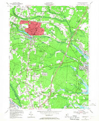
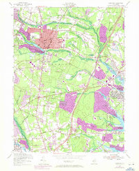
Editions of this 1954 Lakewood Map
3 editions found
Other maps of this area

1884 · Whitings
USGS Topo · 1:62,500

1888 · Barnegat
USGS Topo · 1:62,500

1888 · Asbury Park
USGS Topo · 1:62,500

1888 · Cassville
USGS Topo · 1:62,500

1888 · Whitings
USGS Topo · 1:62,500

1893 · Asbury Park
USGS Topo · 1:62,500

1893 · Barnegat
USGS Topo · 1:62,500

1894 · Cassville
USGS Topo · 1:62,500

1898 · Barnegat
USGS Topo · 1:62,500

1900 · Cassville
USGS Topo · 1:62,500