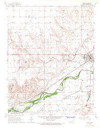
1966 Map of Lakin
USGS Topo · Published 1967About this map
The Arkansas River valley defines the character of this western Kansas landscape, where a sophisticated network of irrigation channels like the Amazon Ditch and Southside Ditch support agriculture along the fertile bottomlands. The town of Lakin serves as the primary hub, situated where the Atchison Topeka and Santa Fe railroad parallels the river. In the western portion of the sheet, the settlement of Hartland and the nearby Hartland Cem mark a secondary node of activity in Hartland township.
Find a feature on this map
21 named features on this map. Tap any name to fly to it.
Don’t see what you’re looking for? This feature index may not catch every label — zoom into the map to look around manually.
Map Details
Editions of this 1966 Lakin Map
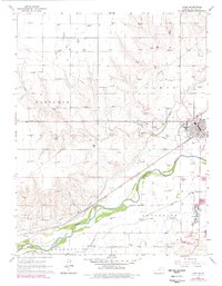
2 editions found
Other maps of this area

1891 · Larned
USGS Topo · 1:125,000

1900 · Lakin
USGS Topo · 1:125,000

1955 · Dodge City
USGS Topo · 1:250,000

1955 · Scott City
USGS Topo · 1:250,000

1958 · Dodge City
USGS Topo · 1:250,000

1958 · Scott City
USGS Topo · 1:250,000

1959 · Dodge City
USGS Topo · 1:250,000
1960 · Deerfield SW
USGS Topo · 1:24,000

1960 · Deerfield
USGS Topo · 1:24,000
1966 · Lakin SE
USGS Topo · 1:24,000