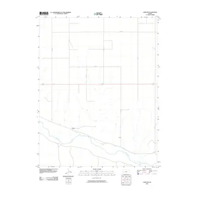
2010 Map of Lakin NW
USGS Topo · Published 2010About this map
The Arkansas River corridor in western Kansas defines this landscape, where the seasonal waters of Sand Creek flow south toward the alluvial plain. The settlement of Sutton sits near the riverbanks, marking a point of human activity in an area largely characterized by the large-scale grid of county roads. Human engineering is evident in the presence of the Amazon Ditch, a significant irrigation feature that runs parallel to the river to support the region's agricultural needs. This 2010 survey illustrates the intersection of natural watercourses and the persistent effort to manage water in the High Plains. To the east, the label Koffman indicates another point of local significance along the road network, while a dense system of routes including Co Rd 20 and Co Rd J provides the framework for this rural township's connectivity.
Find a feature on this map
14 named features on this map. Tap any name to fly to it.
Don’t see what you’re looking for? This feature index may not catch every label — zoom into the map to look around manually.
Map Details
Editions of this 2010 Lakin NW Map
This is the sole edition of this map. No revisions or reprints were ever made.
Other maps of this area

1891 · Larned
USGS Topo · 1:125,000

1900 · Syracuse
USGS Topo · 1:125,000

1900 · Lakin
USGS Topo · 1:125,000

1920 · Syracuse
USGS Topo · 1:125,000

1955 · Dodge City
USGS Topo · 1:250,000

1955 · Scott City
USGS Topo · 1:250,000

1958 · Dodge City
USGS Topo · 1:250,000

1958 · Scott City
USGS Topo · 1:250,000

1959 · Dodge City
USGS Topo · 1:250,000
1966 · Lakin SE
USGS Topo · 1:24,000