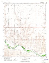
1966 Map of Lakin NW
USGS Topo · Published 1967About this map
The Arkansas River corridor defines the southern portion of this mid-1960s survey, where the valley floor transitions into the rugged drainage of Hartland. This landscape is marked by the heavy infrastructure of the Atchison Topeka and Santa Fe railroad, which parallels the river and passes through the settlement of Sutton. The presence of the Amazon Ditch highlights the critical role of water management and irrigation in Kearny County’s agricultural history, cutting across the terrain to sustain the arid high plains.
Find a feature on this map
12 named features on this map. Tap any name to fly to it.
Don’t see what you’re looking for? This feature index may not catch every label — zoom into the map to look around manually.
Map Details
Editions of this 1966 Lakin NW Map
This is the sole edition of this map. No revisions or reprints were ever made.
Other maps of this area

1891 · Larned
USGS Topo · 1:125,000

1900 · Syracuse
USGS Topo · 1:125,000

1900 · Lakin
USGS Topo · 1:125,000

1920 · Syracuse
USGS Topo · 1:125,000

1955 · Dodge City
USGS Topo · 1:250,000

1955 · Scott City
USGS Topo · 1:250,000

1958 · Dodge City
USGS Topo · 1:250,000

1958 · Scott City
USGS Topo · 1:250,000

1959 · Dodge City
USGS Topo · 1:250,000
1966 · Lakin SE
USGS Topo · 1:24,000