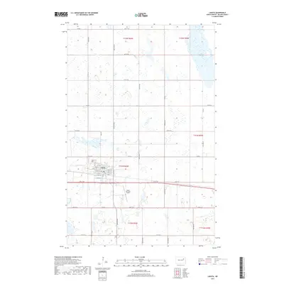
2017 Map of Lakota
USGS Topo · Published 2017About this map
The city of Lakota serves as the focal point of this Nelson County landscape, showcasing a traditional grid-patterned settlement typical of the northern Great Plains. The town is structured around central corridors such as Main St and South St, with residential and commercial streets identified by an alphabetical and numerical system from A Ave W to 6th St E. Local infrastructure is anchored by the Lakota Municipal Airport to the south and the Lakota Cem on the northwestern edge of the community. Beyond the city limits, the terrain is defined by the Public Land Survey System, including townships t153n r60w and t154n r60w. The surrounding prairie is dotted with numerous small wetlands and larger water bodies like McHugh Slough, reflecting the glacial pothole geography of the region.
Find a feature on this map
43 named features on this map. Tap any name to fly to it.
Don’t see what you’re looking for? This feature index may not catch every label — zoom into the map to look around manually.
Map Details
Editions of this 2017 Lakota Map
This is the sole edition of this map. No revisions or reprints were ever made.
Other maps of this area

1930 · Pekin
USGS Topo · 1:62,500

1942 · McVille
USGS Topo · 1:62,500

1951 · Pekin NE
USGS Topo · 1:24,000

1951 · Pekin NW
USGS Topo · 1:24,000

1951 · Pekin
USGS Topo · 1:62,500

1952 · New Rockford
USGS Topo · 1:250,000

1953 · Devils Lake
USGS Topo · 1:250,000

1956 · New Rockford
USGS Topo · 1:250,000

1956 · Devils Lake
USGS Topo · 1:250,000

1970 · Lakota
USGS Topo · 1:24,000