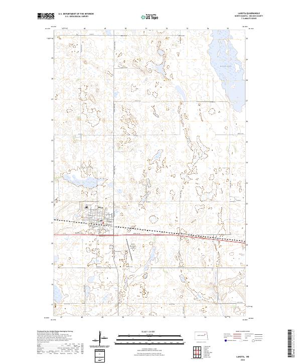
2024 Map of Lakota
USGS Topo · Published 2024About this map
Lakota serves as the focal point of this Nelson County landscape, where the local street grid centers around the Nelson County Courthouse. The town's layout is defined by avenues named with a simple lettered system, including A Ave W and E Ave W, which terminate at the western edge near Lakota Cem. The surrounding terrain is characterized by the prairie pothole region's distinct hydrology, dominated in the northeast by McHugh Slough and the Nelson County Waterfowl Production Area. This conservation land signifies the region's importance for migratory birds and local ecology. Outside the city limits, the landscape transitions into a systematic grid of township and range lines, with the Lakota Municipal Airport positioned to the southeast of the main settlement.
Find a feature on this map
39 named features on this map. Tap any name to fly to it.
Don’t see what you’re looking for? This feature index may not catch every label — zoom into the map to look around manually.
Map Details
Editions of this 2024 Lakota Map
This is the sole edition of this map. No revisions or reprints were ever made.
Other maps of this area

1930 · Pekin
USGS Topo · 1:62,500

1942 · McVille
USGS Topo · 1:62,500

1951 · Pekin NE
USGS Topo · 1:24,000

1951 · Pekin NW
USGS Topo · 1:24,000

1951 · Pekin
USGS Topo · 1:62,500

1952 · New Rockford
USGS Topo · 1:250,000

1953 · Devils Lake
USGS Topo · 1:250,000

1956 · New Rockford
USGS Topo · 1:250,000

1956 · Devils Lake
USGS Topo · 1:250,000

1970 · Lakota
USGS Topo · 1:24,000