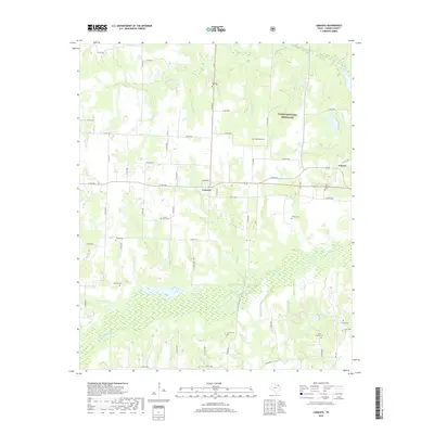
2019 Map of Lamasco
USGS Topo · Published 2019About this map
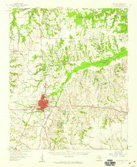
Lamasco and Carson anchor this rural Fannin County landscape, where the northern reaches of the Caddo National Grassland provide a backdrop of preserved terrain. The area is defined by a dense network of watercourses, including the westward flow of Bois d'Arc Cr and the branching systems of Coffee Mill Cr and Sandy Cr. For the family historian, the map is particularly detailed in its documentation of local burial sites, many of which are associated with the early settlement of this North Texas region. From Pilgrims Rest Cem in the north to the Smith Family Cem further south, these locations provide critical geographic touchpoints for genealogical research. The survey also identifies the uniquely named Orphanage Cem near Wild-Horse Br, alongside several other named tributaries such as Tanbark Cr and Spoonamore Cr that have shaped the agricultural layout of the county.
Find a feature on this map
68 named features on this map. Tap any name to fly to it.
Don’t see what you’re looking for? This feature index may not catch every label — zoom into the map to look around manually.
Map Details
Editions of this 2019 Lamasco Map
This is the sole edition of this map. No revisions or reprints were ever made.
Other maps of this area
1903 · Paris
USGS Topo · 1:125,000
1947 · Honey Grove
USGS Topo · 1:62,500
1948 · Direct
USGS Topo · 1:62,500
1949 · Direct
USGS Topo · 1:62,500
1949 · Honey Grove
USGS Topo · 1:62,500

1953 · Texarkana
USGS Topo · 1:250,000

1954 · Sherman
USGS Topo · 1:250,000
1956 · Texarkana
USGS Topo · 1:250,000
1957 · Wade
USGS Topo · 1:62,500
1958 · Bonham
USGS Topo · 1:62,500