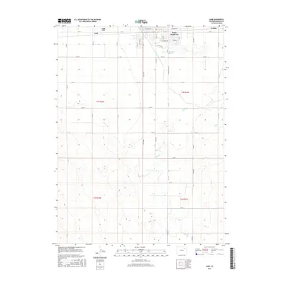
2016 Map of Lamb
USGS Topo · Published 2016About this map
Fort Morgan serves as the primary urban center in this high-plains landscape, where the town's grid meets the extensive irrigation systems of the Fort Morgan Canal and Bijou Canal. These waterworks are essential to the agricultural identity of the region, diverting water across the flat terrain to support farms near Lamb and Moseley. The map highlights a transition from the structured residential blocks of the city, including Ram Ave and Southridge Rd, to a vast rural section-line road network. To the south and east, the natural drainage of Badger Cr meanders through the prairie, contrasting with the straight lines of the man-made canals. This 2016 survey documents the modern layout of these vital water corridors as they continue to define the development and economy of Morgan County.
Find a feature on this map
25 named features on this map. Tap any name to fly to it.
Don’t see what you’re looking for? This feature index may not catch every label — zoom into the map to look around manually.
Map Details
Editions of this 2016 Lamb Map
This is the sole edition of this map. No revisions or reprints were ever made.
Other maps of this area

1951 · Weldona
USGS Topo · 1:24,000

1951 · Brush West
USGS Topo · 1:24,000

1951 · Fort Morgan
USGS Topo · 1:24,000

1954 · Sterling
USGS Topo · 1:250,000

1958 · Sterling
USGS Topo · 1:250,000

1963 · Lamb
USGS Topo · 1:24,000

1963 · Round Top
USGS Topo · 1:24,000

1963 · Vallery
USGS Topo · 1:24,000

1963 · Adena
USGS Topo · 1:24,000

1965 · Vallery SE
USGS Topo · 1:24,000