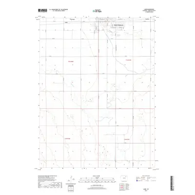
2019 Map of Lamb
USGS Topo · Published 2019About this map
The southern portion of Fort Morgan serves as the focal point of this Morgan County landscape, where the agricultural plains meet the structured grid of the town’s residential development. The map reveals a sophisticated irrigation network essential to the High Plains, featuring the winding Fort Morgan Canal and the Bijou Canal as they cut through the section lines. Small rural hubs like Lamb and Moseley are located along the northern corridor near the rail lines, while Trail Side sits further west. The topography is defined by the gradual drainage of Badger Cr, showing the transition from the high, flat plateaus into the lower draws and ravines that shape the surrounding farmland. This survey provides a precise look at the 2019 road grid, including Sherman Street Rd and various county routes that anchor the local rural economy.
Find a feature on this map
42 named features on this map. Tap any name to fly to it.
Don’t see what you’re looking for? This feature index may not catch every label — zoom into the map to look around manually.
Map Details
Editions of this 2019 Lamb Map
This is the sole edition of this map. No revisions or reprints were ever made.
Other maps of this area

1951 · Weldona
USGS Topo · 1:24,000

1951 · Brush West
USGS Topo · 1:24,000

1951 · Fort Morgan
USGS Topo · 1:24,000

1954 · Sterling
USGS Topo · 1:250,000

1958 · Sterling
USGS Topo · 1:250,000

1963 · Lamb
USGS Topo · 1:24,000

1963 · Round Top
USGS Topo · 1:24,000

1963 · Vallery
USGS Topo · 1:24,000

1963 · Adena
USGS Topo · 1:24,000

1965 · Vallery SE
USGS Topo · 1:24,000