
2011 Map of Lambs Lake NE
USGS Topo · Published 2011About this map
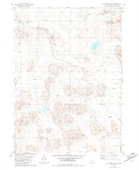
Dry Creek meanders across this northern Nebraska landscape, defining the hydrology of a region characterized by dispersed wetlands and seasonal watercourses. This 2011 survey by the U.S. Geological Survey illustrates the transition of the Sandhills terrain within Holt County, where a network of small, unnamed ponds and ephemeral basins punctuate the prairie. The map's sparse nomenclature reflects a territory dominated by large-scale ranching and open space, with section lines and local roads providing the primary framework for land management and navigation. For those studying Nebraska's environmental history or modern land use, this sheet documents the natural drainage patterns and water resources that sustain the area's agricultural heritage.
Find a feature on this map
1 named feature on this map. Tap any name to fly to it.
Don’t see what you’re looking for? This feature index may not catch every label — zoom into the map to look around manually.
Map Details
Editions of this 2011 Lambs Lake NE Map
This is the sole edition of this map. No revisions or reprints were ever made.
Other maps of this area

1954 · Stuart
USGS Topo · 1:24,000

1954 · Atkinson
USGS Topo · 1:24,000

1954 · Stuart SE
USGS Topo · 1:24,000

1955 · O'Neill
USGS Topo · 1:250,000

1959 · O'Neill
USGS Topo · 1:250,000

1964 · Emmet NW
USGS Topo · 1:24,000

1964 · Emmet SW
USGS Topo · 1:24,000

1969 · O'Neill
USGS Topo · 1:250,000
1982 · Cottonwood Lake
USGS Topo · 1:24,000

1982 · Dora Lake
USGS Topo · 1:24,000