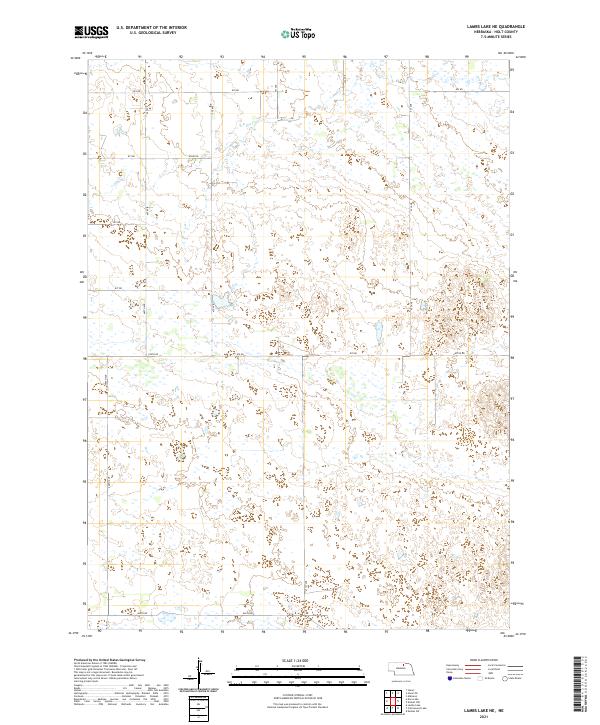
2021 Map of Lambs Lake NE
USGS Topo · Published 2021About this map
Dry Cr meanders across this rural expanse of Holt County, defining a landscape shaped by intermittent water and a strict section-line grid. This modern survey reflects the enduring structure of the Public Land Survey System, with township and range lines like t29n r15w and t28n r14w organizing the Nebraska prairie into manageable parcels. The area is defined by its sparse but vital road network, where routes such as 874 Rd and 870 Rd serve as the primary conduits for agricultural life. While few named landmarks appear on this specific sheet, the intricate topographic contours and wetland indicators suggest a terrain of depressions and subtle rises typical of the Nebraska Sandhills. Local connectivity is maintained through numbered avenues and roads, including 866th Rd and 873rd Rd, which trace the history of land division and residency in this quiet corner of the state.
Find a feature on this map
22 named features on this map. Tap any name to fly to it.
Don’t see what you’re looking for? This feature index may not catch every label — zoom into the map to look around manually.
Map Details
Editions of this 2021 Lambs Lake NE Map
This is the sole edition of this map. No revisions or reprints were ever made.
Other maps of this area

1954 · Stuart
USGS Topo · 1:24,000

1954 · Atkinson
USGS Topo · 1:24,000

1954 · Stuart SE
USGS Topo · 1:24,000

1955 · O'Neill
USGS Topo · 1:250,000

1959 · O'Neill
USGS Topo · 1:250,000

1964 · Emmet NW
USGS Topo · 1:24,000

1964 · Emmet SW
USGS Topo · 1:24,000

1969 · O'Neill
USGS Topo · 1:250,000
1982 · Cottonwood Lake
USGS Topo · 1:24,000

1982 · Dora Lake
USGS Topo · 1:24,000