
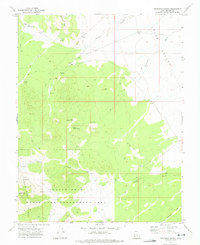
1971 Map of Lamerdorf Peak NW
USGS Topo · Published 1974About this map
Pine Valley dominates this high-desert landscape in Beaver County, where water management is the primary marker of human activity. This 1971 field-checked survey reveals a network of high-altitude water catchments, including the CCC Reservoir, Central Pine Reservoir, and Red Cove Reservoir. These features, often built during earlier conservation eras, suggest the importance of supporting livestock or controlling runoff in an area defined by significant seasonal drainage. The terrain is deeply etched by a system of washes, most notably Jackson Wash and Antelope Wash, which flow from the surrounding elevations toward the valley floor. The map also records localized improvements like the Chamisa Reservoir and scattered corrals, indicating a landscape utilized for ranching and resource management rather than permanent residential settlement.
Find a feature on this map
10 named features on this map. Tap any name to fly to it.
Don’t see what you’re looking for? This feature index may not catch every label — zoom into the map to look around manually.
Map Details
Editions of this 1971 Lamerdorf Peak NW Map
This is the sole edition of this map. No revisions or reprints were ever made.
Other maps of this area

1953 · Richfield
USGS Topo · 1:250,000

1958 · Richfield
USGS Topo · 1:250,000

1960 · Wah Wah Summit
USGS Topo · 1:62,500

1971 · Pine Grove Reservoir
USGS Topo · 1:24,000

1971 · Sewing Machine Pass
USGS Topo · 1:24,000

1971 · Halfway Summit
USGS Topo · 1:24,000

1971 · Sawtooth Peak
USGS Topo · 1:24,000

1971 · Lamerdorf Peak
USGS Topo · 1:24,000
1972 · Buckhorn Spring
USGS Topo · 1:24,000

1980 · Wah Wah Mts. South
USGS Topo · 1:100,000