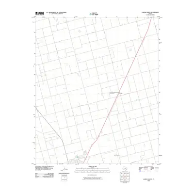
2010 Map of Lamesa North
USGS Topo · Published 2010About this map
Arvana sits at the heart of this West Texas landscape, where the flat agricultural terrain of Dawson County is organized into a rigid grid of ranch roads and county lines. A significant cultural landmark, the Lamesa Farm Workers Community Historic District, is located just west of the main highway, preserving the history of labor and settlement in this productive cotton-growing region. The southern edge of the survey transitions into the outskirts of the county seat, marked by the Lamesa Municipal Airport and the beginning of the local street grid at N Elgin St. The map illustrates the dominance of the ranching and farming infrastructure, defined by an extensive network of secondary routes including Ranch Rd 825, Ranch Rd 2411, and family-named thoroughfares such as Cord L & Woody Rd.
Find a feature on this map
18 named features on this map. Tap any name to fly to it.
Don’t see what you’re looking for? This feature index may not catch every label — zoom into the map to look around manually.
Map Details
Editions of this 2010 Lamesa North Map
This is the sole edition of this map. No revisions or reprints were ever made.
Other maps of this area

1954 · Hobbs
USGS Topo · 1:250,000

1954 · Big Spring
USGS Topo · 1:250,000

1958 · Big Spring
USGS Topo · 1:250,000

1958 · Hobbs
USGS Topo · 1:250,000

1968 · Lamesa North
USGS Topo · 1:24,000

1968 · Hancock
USGS Topo · 1:24,000

1969 · Welch East
USGS Topo · 1:24,000

1969 · Gooch Lake
USGS Topo · 1:24,000

1969 · O'Donnell
USGS Topo · 1:24,000

1969 · Punkin Center
USGS Topo · 1:24,000