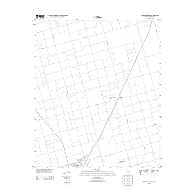
2012 Map of Lamesa North
USGS Topo · Published 2012About this map
Arvana and the northern edge of Lamesa anchor this Dawson County landscape, which transitions from organized town blocks into a vast network of section roads. A significant historical site, the Lamesa Farm Workers Community Historic District, is located northeast of the city center, marking the region's agricultural heritage. The southern portion of the map captures the urban development of Lamesa, showing a grid of residential and commercial streets such as Chicago Dr and N Elgin Ave. Beyond the city limits, the terrain is defined by its rural connectivity, where routes like Ranch Road 2411 and Woody Rd carve through the High Plains. The presence of the Lamesa Municipal Airport on the southeastern edge highlights the importance of regional aviation to this west Texas community.
Find a feature on this map
27 named features on this map. Tap any name to fly to it.
Don’t see what you’re looking for? This feature index may not catch every label — zoom into the map to look around manually.
Map Details
Editions of this 2012 Lamesa North Map
This is the sole edition of this map. No revisions or reprints were ever made.
Other maps of this area

1954 · Hobbs
USGS Topo · 1:250,000

1954 · Big Spring
USGS Topo · 1:250,000

1958 · Big Spring
USGS Topo · 1:250,000

1958 · Hobbs
USGS Topo · 1:250,000

1968 · Lamesa North
USGS Topo · 1:24,000

1968 · Hancock
USGS Topo · 1:24,000

1969 · Welch East
USGS Topo · 1:24,000

1969 · Gooch Lake
USGS Topo · 1:24,000

1969 · O'Donnell
USGS Topo · 1:24,000

1969 · Punkin Center
USGS Topo · 1:24,000