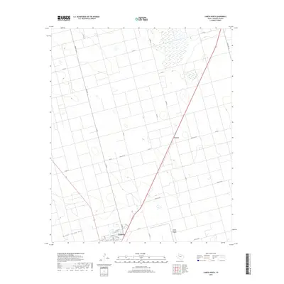
2019 Map of Lamesa North
USGS Topo · Published 2019About this map
The agricultural landscape of the Llano Estacado dominates this survey of northern Lamesa and the surrounding high plains of Dawson County. The grid-based settlement pattern is interrupted by the natural course of Sulphur Springs Draw, which cuts across the southwestern corner of the quadrangle. As a regional hub, the northern edge of the city shows a transition from urban streets like Chicago Dr and N Main Ave to the industrial and logistical infrastructure of the Lamesa Municipal Airport. Beyond the city limits, the terrain is defined by wide expanses of ranching and farming land, interconnected by a rigorous network of county roads and state routes. The small community of Arvana sits north of the city center along the primary highway corridor, serving as a distinct waypoint in an area otherwise characterized by systematic land divisions and dispersed rural residences.
Find a feature on this map
30 named features on this map. Tap any name to fly to it.
Don’t see what you’re looking for? This feature index may not catch every label — zoom into the map to look around manually.
Map Details
Editions of this 2019 Lamesa North Map
This is the sole edition of this map. No revisions or reprints were ever made.
Other maps of this area

1954 · Hobbs
USGS Topo · 1:250,000

1954 · Big Spring
USGS Topo · 1:250,000

1958 · Big Spring
USGS Topo · 1:250,000

1958 · Hobbs
USGS Topo · 1:250,000

1968 · Lamesa North
USGS Topo · 1:24,000

1968 · Hancock
USGS Topo · 1:24,000

1969 · Welch East
USGS Topo · 1:24,000

1969 · Gooch Lake
USGS Topo · 1:24,000

1969 · O'Donnell
USGS Topo · 1:24,000

1969 · Punkin Center
USGS Topo · 1:24,000