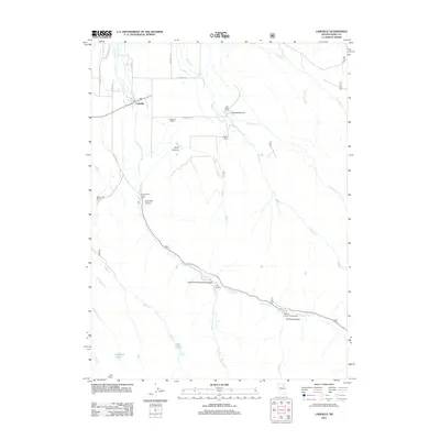
2012 Map of Lamoille
USGS Topo · Published 2012About this map
The settlement of Lamoille serves as a hub for this high-desert ranching and recreation area, located at the foot of dramatic peaks. A network of family-owned ranching operations, including the Westlund Ranch, Lee Miller Ranch, and Vignolo Ranch, are situated along the drainage of Lamoille Cr and its tributaries. These waterways descend from steep canyons like Conrad Canyon and Snell Canyon, feeding the agricultural life of the valley.
Find a feature on this map
37 named features on this map. Tap any name to fly to it.
Don’t see what you’re looking for? This feature index may not catch every label — zoom into the map to look around manually.
Map Details
Editions of this 2012 Lamoille Map
This is the sole edition of this map. No revisions or reprints were ever made.
Other maps of this area

1935 · Halleck
USGS Topo · 1:125,000

1955 · Elko
USGS Topo · 1:250,000

1958 · Elko
USGS Topo · 1:250,000

1962 · Elko
USGS Topo · 1:250,000

1962 · Boyd Reservoir
USGS Topo · 1:24,000

1962 · Lee
USGS Topo · 1:62,500

1962 · Lamoille
USGS Topo · 1:62,500

1965 · Elko
USGS Topo · 1:250,000
1970 · Soldier Peak
USGS Topo · 1:24,000
1971 · Halleck SW
USGS Topo · 1:24,000