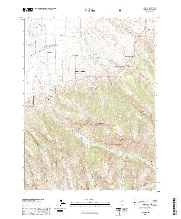
2021 Map of Lamoille
USGS Topo · Published 2021About this map
Lamoille Valley serves as the gateway to the high peaks of the Ruby Mountains, where the small settlement of Lamoille marks the transition from agricultural lowlands to the alpine canyons of the Humboldt National Forest. In this 2021 update, the intricate network of glacial drainages is clearly mapped, including the dramatic Lamoille Canyon and Seitz Canyon. The map details the recreational and ranching infrastructure of the region, from family-named routes like Blume Ranch Rd to the various trails leading to high-elevation water bodies like Seitz Lake and Griswold Lake. Notable landmarks include Camp Lamoille and the Lions Camp Trl, highlighting the area's long-standing importance as a destination for outdoor education and mountain exploration. The steep rise toward summits such as Lee Peak and Mt Gilbert illustrates the high-relief topography characteristic of the Great Basin's most prominent ranges.
Find a feature on this map
64 named features on this map. Tap any name to fly to it.
Don’t see what you’re looking for? This feature index may not catch every label — zoom into the map to look around manually.
Map Details
Editions of this 2021 Lamoille Map
This is the sole edition of this map. No revisions or reprints were ever made.
Other maps of this area

1935 · Halleck
USGS Topo · 1:125,000

1955 · Elko
USGS Topo · 1:250,000

1958 · Elko
USGS Topo · 1:250,000

1962 · Elko
USGS Topo · 1:250,000

1962 · Boyd Reservoir
USGS Topo · 1:24,000

1962 · Lee
USGS Topo · 1:62,500

1962 · Lamoille
USGS Topo · 1:62,500

1965 · Elko
USGS Topo · 1:250,000
1970 · Soldier Peak
USGS Topo · 1:24,000
1971 · Halleck SW
USGS Topo · 1:24,000