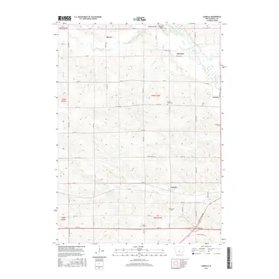
2015 Map of LaMoille
USGS Topo · Published 2015About this map
Lamoille and the surrounding rural landscapes of Marshall County are defined by a network of creeks and small settlements tied to the land's agricultural rhythm. The terrain is marked by notable elevations such as Mormon Ridge to the north, overlooking Minerva Creek and its tributary Little Minerva Br. This 2015 survey reveals a significant concentration of small, denominational, and civic burial grounds, including the Hartland Friends Cem, Hixite Cem, and the County Home Cem. These sites, along with the settlement at Marietta and the smaller community of Moningers, provide essential data points for understanding the nineteenth-century Quaker influence and social history of the region. The Iowa River cuts through the northeastern corner, while Linn Cr winds across the southern half, illustrating the hydrologic system that once supported early settlement and transportation routes like Marshalltown Blvd.
Find a feature on this map
37 named features on this map. Tap any name to fly to it.
Don’t see what you’re looking for? This feature index may not catch every label — zoom into the map to look around manually.
Map Details
Editions of this 2015 LaMoille Map
This is the sole edition of this map. No revisions or reprints were ever made.
Other maps of this area

1954 · Waterloo
USGS Topo · 1:250,000

1954 · Des Moines
USGS Topo · 1:250,000

1955 · Waterloo
USGS Topo · 1:250,000

1956 · Des Moines
USGS Topo · 1:250,000

1957 · Des Moines
USGS Topo · 1:250,000

1960 · Marshalltown
USGS Topo · 1:24,000

1960 · Marshalltown
USGS Topo · 1:62,500

1960 · Conrad West
USGS Topo · 1:24,000

1969 · Des Moines
USGS Topo · 1:250,000

1975 · State Center NW
USGS Topo · 1:24,000