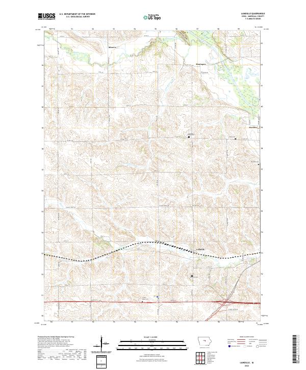
2022 Map of LaMoille
USGS Topo · Published 2022About this map
Minerva Creek and the Iowa River define the drainage patterns of this Marshall County landscape, where small agricultural settlements like Lamoille and Minerva anchor the rural grid. The terrain is notably marked by Mormon Ridge in the northern section, rising above the surrounding creek valleys. This survey provides a clear view of the area's social geography through its numerous small burial grounds, including the Hartland Friends Cem and Hixite Cem, which suggest the diverse denominational history of early settlers.
Find a feature on this map
50 named features on this map. Tap any name to fly to it.
Don’t see what you’re looking for? This feature index may not catch every label — zoom into the map to look around manually.
Map Details
Editions of this 2022 LaMoille Map
This is the sole edition of this map. No revisions or reprints were ever made.
Other maps of this area

1954 · Waterloo
USGS Topo · 1:250,000

1954 · Des Moines
USGS Topo · 1:250,000

1955 · Waterloo
USGS Topo · 1:250,000

1956 · Des Moines
USGS Topo · 1:250,000

1957 · Des Moines
USGS Topo · 1:250,000

1960 · Marshalltown
USGS Topo · 1:24,000

1960 · Marshalltown
USGS Topo · 1:62,500

1960 · Conrad West
USGS Topo · 1:24,000

1969 · Des Moines
USGS Topo · 1:250,000

1975 · State Center NW
USGS Topo · 1:24,000
Featured Places
- Bangor Township, IA
- Minerva Township, IA
- Liberty Township, IA
- State Center Township, IA
- Marietta Township, IA