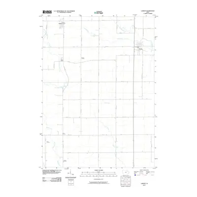
2010 Map of Lamont
USGS Topo · Published 2010About this map
The town of Lamont and the village of Aurora anchor this Buchanan County landscape, where the agricultural grid is defined by a dense network of named roads like Slater Ave and Union Ave. This region is heavily shaped by the drainage patterns of the South Fork Maquoketa River and the East Branch Buffalo Creek, creating a varied topography for the local farmsteads. Genealogists will find significant value in the distribution of several rural burial grounds, including Madison Cemetery, Payne Cemetery, Byron Cemetery, and Fremont Cemetery, which are scattered throughout the townships. The map documents local civic hubs at the Lamont Post Office and Aurora Post Office, alongside the settlement at Buffalo Grove. This survey reflects the enduring rural character of northeast Iowa, showing the relationship between established community centers and the surrounding prairie waterways like Prairie Creek and Dry Creek.
Find a feature on this map
39 named features on this map. Tap any name to fly to it.
Don’t see what you’re looking for? This feature index may not catch every label — zoom into the map to look around manually.
Map Details
Editions of this 2010 Lamont Map
This is the sole edition of this map. No revisions or reprints were ever made.
Other maps of this area

1901 · Oelwein
USGS Topo · 1:125,000

1903 · Winthrop
USGS Topo · 1:125,000

1959 · Dubuque
USGS Topo · 1:250,000

1961 · Dubuque
USGS Topo · 1:250,000

1962 · Dubuque
USGS Topo · 1:250,000

1965 · Strawberry Point
USGS Topo · 1:24,000

1965 · Arlington
USGS Topo · 1:24,000

1965 · Lamont
USGS Topo · 1:24,000

1965 · Dundee
USGS Topo · 1:24,000
1973 · Quasqueton
USGS Topo · 1:24,000