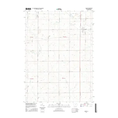
2015 Map of Lamont
USGS Topo · Published 2015About this map
The town of Lamont serves as the primary hub in this eastern Iowa landscape, situated at the junction of Co Rd C64 and Washburn Ave. The terrain is defined by a dense network of watercourses, including the S Fork Maquoketa River and Lamont Cr, which flow through the agricultural fields of Buchanan County. This 2015 survey reveals a pattern of rural preservation, marked by several small family and community burial grounds scattered across the townships. Genealogists will find the locations of Madison Cem, Byron Cem, Payne Cem, and Fremont Cem particularly valuable for tracing local lineages. The grid of section lines and gravel roads, such as Level B Low Maintance Rd, reflects the enduring agrarian structure of the region, while the headwaters of E Br Buffalo Cr and Prairie Cr provide a glimpse into the natural drainage system of the Iowa prairie.
Find a feature on this map
53 named features on this map. Tap any name to fly to it.
Don’t see what you’re looking for? This feature index may not catch every label — zoom into the map to look around manually.
Map Details
Editions of this 2015 Lamont Map
This is the sole edition of this map. No revisions or reprints were ever made.
Other maps of this area

1901 · Oelwein
USGS Topo · 1:125,000

1903 · Winthrop
USGS Topo · 1:125,000

1959 · Dubuque
USGS Topo · 1:250,000

1961 · Dubuque
USGS Topo · 1:250,000

1962 · Dubuque
USGS Topo · 1:250,000

1965 · Strawberry Point
USGS Topo · 1:24,000

1965 · Arlington
USGS Topo · 1:24,000

1965 · Lamont
USGS Topo · 1:24,000

1965 · Dundee
USGS Topo · 1:24,000
1973 · Quasqueton
USGS Topo · 1:24,000