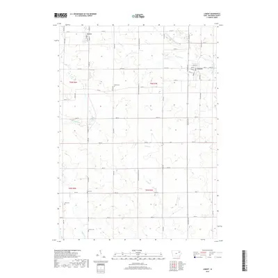
2018 Map of Lamont
USGS Topo · Published 2018About this map
Lamont and Aurora anchor the landscape of northeastern Buchanan County in this late-period survey. The region is defined by a dense network of watercourses, including the S Fork Maquoketa River and several branches of Buffalo Cr, which cut through the agricultural sections. For genealogists and local historians, the presence of well-distributed burial grounds such as Madison Cem, Byron Cem, Payne Cem, and Fremont Cem provides vital points of reference for family research. The infrastructure is characterized by a precise grid of county roads and distinctive paths like the Level B Low Maintance Rd, reflecting the rural character and land-use patterns of the early twenty-first century. These features, along with smaller tributaries like Prairie Cr and Lamont Cr, showcase the drainage and settlement layout that has shaped this part of Iowa.
Find a feature on this map
54 named features on this map. Tap any name to fly to it.
Don’t see what you’re looking for? This feature index may not catch every label — zoom into the map to look around manually.
Map Details
Editions of this 2018 Lamont Map
This is the sole edition of this map. No revisions or reprints were ever made.
Other maps of this area

1901 · Oelwein
USGS Topo · 1:125,000

1903 · Winthrop
USGS Topo · 1:125,000

1959 · Dubuque
USGS Topo · 1:250,000

1961 · Dubuque
USGS Topo · 1:250,000

1962 · Dubuque
USGS Topo · 1:250,000

1965 · Strawberry Point
USGS Topo · 1:24,000

1965 · Arlington
USGS Topo · 1:24,000

1965 · Lamont
USGS Topo · 1:24,000

1965 · Dundee
USGS Topo · 1:24,000
1973 · Quasqueton
USGS Topo · 1:24,000