2022 Map of Lamont
USGS Topo · Published 2022About this map
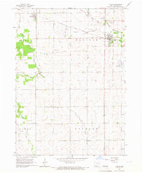
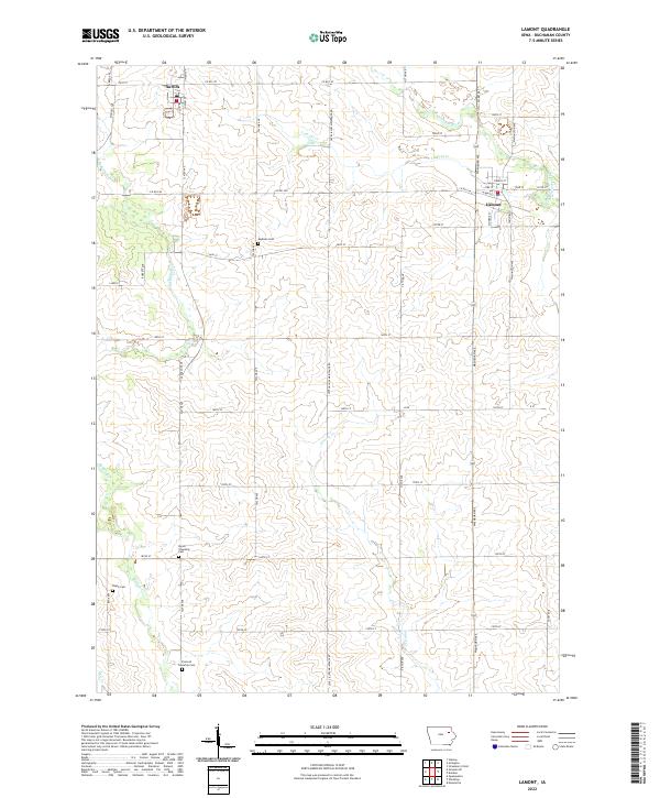
Lamont and Aurora anchor this agricultural landscape in northeast Buchanan County, where a network of section-line roads defines the rural character. The settlement at Lamont is positioned near the S Br Maquoketa River, while Aurora sits at the headwaters of the E Br Buffalo Cr. This 2022 survey illustrates the persistent township organization of the region, featuring four distinct burial grounds that provide critical focal points for local history and genealogy: Madison Cem, Byron Township Cem, Fremont Township Cem, and Payne Cem. A delicate web of waterways, including Lamont Cr, Prairie Cr, and Dry Cr, drain the slightly varied elevations of the farmland, highlighting the importance of the river systems to the area's original settlement and ongoing drainage patterns.
Find a feature on this map
50 named features on this map. Tap any name to fly to it.
Don’t see what you’re looking for? This feature index may not catch every label — zoom into the map to look around manually.
Map Details
Editions of this 2022 Lamont Map
This is the sole edition of this map. No revisions or reprints were ever made.