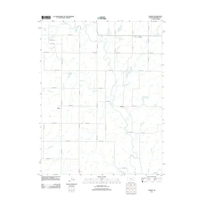
2012 Map of Lamont
USGS Topo · Published 2012About this map
The Verdigris River snakes through this section of Greenwood County, defining the drainage patterns for numerous local tributaries. In the north, Lamont serves as a focal point for the regional road network, while the small communities of Hilltop and Bisbee are situated further south and west, respectively. This landscape is characterized by its agricultural grid, where townships and range lines are meticulously mapped through an extensive system of local roads, such as TWP HWY 232 and Co HWY 3. The presence of the Godfrey Airport north of Holderman Cr provides a glimpse into the localized transportation infrastructure of the early 21st century. Researchers can trace the varied courses of Van Horn Cr, Long Cr, and Greenhall Cr as they feed into the primary river system, reflecting the hydrologic character of this Kansas prairie terrain.
Find a feature on this map
38 named features on this map. Tap any name to fly to it.
Don’t see what you’re looking for? This feature index may not catch every label — zoom into the map to look around manually.
Map Details
Editions of this 2012 Lamont Map
This is the sole edition of this map. No revisions or reprints were ever made.
Other maps of this area

1885 · Burlington
USGS Topo · 1:125,000

1885 · Eureka
USGS Topo · 1:125,000

1886 · Fredonia
USGS Topo · 1:125,000

1888 · Emporia
USGS Topo · 1:125,000

1888 · Eureka
USGS Topo · 1:125,000

1894 · Emporia
USGS Topo · 1:125,000

1894 · Fredonia
USGS Topo · 1:125,000

1894 · Burlington
USGS Topo · 1:125,000

1894 · Eureka
USGS Topo · 1:125,000

1947 · Lawrence
USGS Topo · 1:250,000