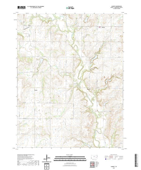
2022 Map of Lamont
USGS Topo · Published 2022About this map
Verdigris River and its numerous tributaries, including Halderman Cr and Van Horn Cr, define the landscape of this eastern Kansas region. The small settlement of Lamont sits in the northeast, while Hilltop and Bisbee occupy the central and western portions of the quadrangle. The terrain is a network of section roads and drainage basins, reflecting the long-established agricultural grid of Greenwood County. A localized landmark, Godfrey Airport, is situated near the northern boundary, serving the rural aviation needs of the area. The map illustrates the hydrology of the Flint Hills fringe, where seasonal streams like Long Creek and Greenhalgh Cr carve subtle valleys through the upland plains. This 2022 survey provides a modern accounting of these quiet communities and the persistent drainage patterns that have shaped local property lines and travel routes for generations.
Find a feature on this map
53 named features on this map. Tap any name to fly to it.
Don’t see what you’re looking for? This feature index may not catch every label — zoom into the map to look around manually.
Map Details
Editions of this 2022 Lamont Map
This is the sole edition of this map. No revisions or reprints were ever made.
Other maps of this area

1885 · Burlington
USGS Topo · 1:125,000

1885 · Eureka
USGS Topo · 1:125,000

1886 · Fredonia
USGS Topo · 1:125,000

1888 · Emporia
USGS Topo · 1:125,000

1888 · Eureka
USGS Topo · 1:125,000

1894 · Emporia
USGS Topo · 1:125,000

1894 · Fredonia
USGS Topo · 1:125,000

1894 · Burlington
USGS Topo · 1:125,000

1894 · Eureka
USGS Topo · 1:125,000

1947 · Lawrence
USGS Topo · 1:250,000