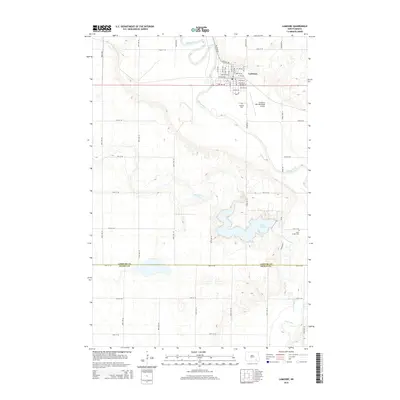
2014 Map of LaMoure
USGS Topo · Published 2014About this map
LaMoure serves as the focal point of this region in the southeastern plains, situated along the winding path of the James River. The town layout is clearly defined by its street grid, featuring Main St NW and a series of numbered avenues and streets that radiate from the core. Agricultural and aviation interests are represented nearby at the La Moure Rott Municipal Airport, while local history is anchored by Rosehill Cem on the town's southern edge and Saint Ansgar Cem further south near Cottonwood Cr. The landscape is dominated by water features including Lake LaMoure and Nevermore Lake, which illustrate the hydrology of the area as it crosses the boundary between LaMoure and Dickey counties. This survey provides a precise look at the township and range grid that continues to organize this prairie landscape.
Find a feature on this map
50 named features on this map. Tap any name to fly to it.
Don’t see what you’re looking for? This feature index may not catch every label — zoom into the map to look around manually.
Map Details
Editions of this 2014 LaMoure Map
This is the sole edition of this map. No revisions or reprints were ever made.
Other maps of this area

1894 · La Moure
USGS Topo · 1:62,500

1894 · Fullerton
USGS Topo · 1:62,500

1894 · Oakes
USGS Topo · 1:62,500

1895 · Lamoure
USGS Topo · 1:125,000

1918 · La Moure
USGS Topo · 1:125,000

1952 · Glover
USGS Topo · 1:24,000

1952 · Grand Rapids
USGS Topo · 1:24,000

1952 · Independence
USGS Topo · 1:24,000

1953 · Jamestown
USGS Topo · 1:250,000

1955 · Fullerton NE
USGS Topo · 1:24,000