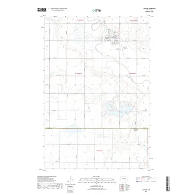
2017 Map of LaMoure
USGS Topo · Published 2017About this map
The James River meanders through the heart of this North Dakota landscape, anchoring the city of LaMoure. This late-2010s survey reveals a well-ordered agricultural grid defined by local thoroughfares like 72nd St SE and Co Rd 60, connecting the regional hub to its surrounding prairie lands. The map captures essential civic and memorial sites, including the Rosehill Cem near the town center and the Saint Ansgar Lutheran Cem further south near the LaMoure Co Dickey Co boundary. Water features are prominent, with the substantial Lake LaMoure and the smaller Nevermore Lake providing distinct geographic markers within the township sections. Transportation and utility are represented by the La Moure Rott Municipal Airport, which sits just east of the primary settlement, while Cottonwood Cr flows through the southern reaches of the quadrangle.
Find a feature on this map
27 named features on this map. Tap any name to fly to it.
Don’t see what you’re looking for? This feature index may not catch every label — zoom into the map to look around manually.
Map Details
Editions of this 2017 LaMoure Map
This is the sole edition of this map. No revisions or reprints were ever made.
Other maps of this area

1894 · La Moure
USGS Topo · 1:62,500

1894 · Fullerton
USGS Topo · 1:62,500

1894 · Oakes
USGS Topo · 1:62,500

1895 · Lamoure
USGS Topo · 1:125,000

1918 · La Moure
USGS Topo · 1:125,000

1952 · Glover
USGS Topo · 1:24,000

1952 · Grand Rapids
USGS Topo · 1:24,000

1952 · Independence
USGS Topo · 1:24,000

1953 · Jamestown
USGS Topo · 1:250,000

1955 · Fullerton NE
USGS Topo · 1:24,000